Indigenous Maps & Mapping
One of the most frequent suggestions / requests that I have received in relation to my map of the Salish Sea is to make a more “indigenous” version of the map. Most often what this has meant would be the replacing of the European-American-colonial-current place names with indigenous place names (or including both). I think this is a wonderful idea, but I have found it more complicated in practice than in concept.
In the first place, given the complex, overlapping historical territories of the many indigenous tribes and first nations within the Salish Sea area, most locations have not one but numerous, different indigenous place names. Even where there is some common agreement on a name there are often multiple spellings. Deciding which version of an indigenous place name is the correct one becomes a formidable challenge, and hardly one that I, as a non-indigenous cartographer, feel empowered to undertake. And any indigenous place name added to the map (using the name / language / spelling of one group) has the potential to offend numerous other, adjacent groups. I have often replied that I would be happy to undertake such a map if and when someone can supply me with a list of approved indigenous place names. So far no one has taken me up on the offer.
There is also the possibility of including multiple indigenous names for each of the location-based text on the map. Cartographically, even adding a single indigenous name alongside each of the existing place names on the map presents a challenge (technical as well as artistic). Including multiple names would only further complicate this.
Taking the idea of an indigenous map further, some have suggested a version of the map that includes additional indigenous place names and territory boundaries (historical or current). In addition to the issues of language and spelling, the changeable (and often contested) territorial boundaries. And again, a worth undertaking, but not one that I feel qualified to tackle.
As an aside, all of these issues create an excellent case study in the complexities of 'indigenous’ mapping and the contrasts between different cultural ways of describing and defining space. Clearly the current mapping / naming / management styles are a product of the current, dominant cultural power…
Static Maps
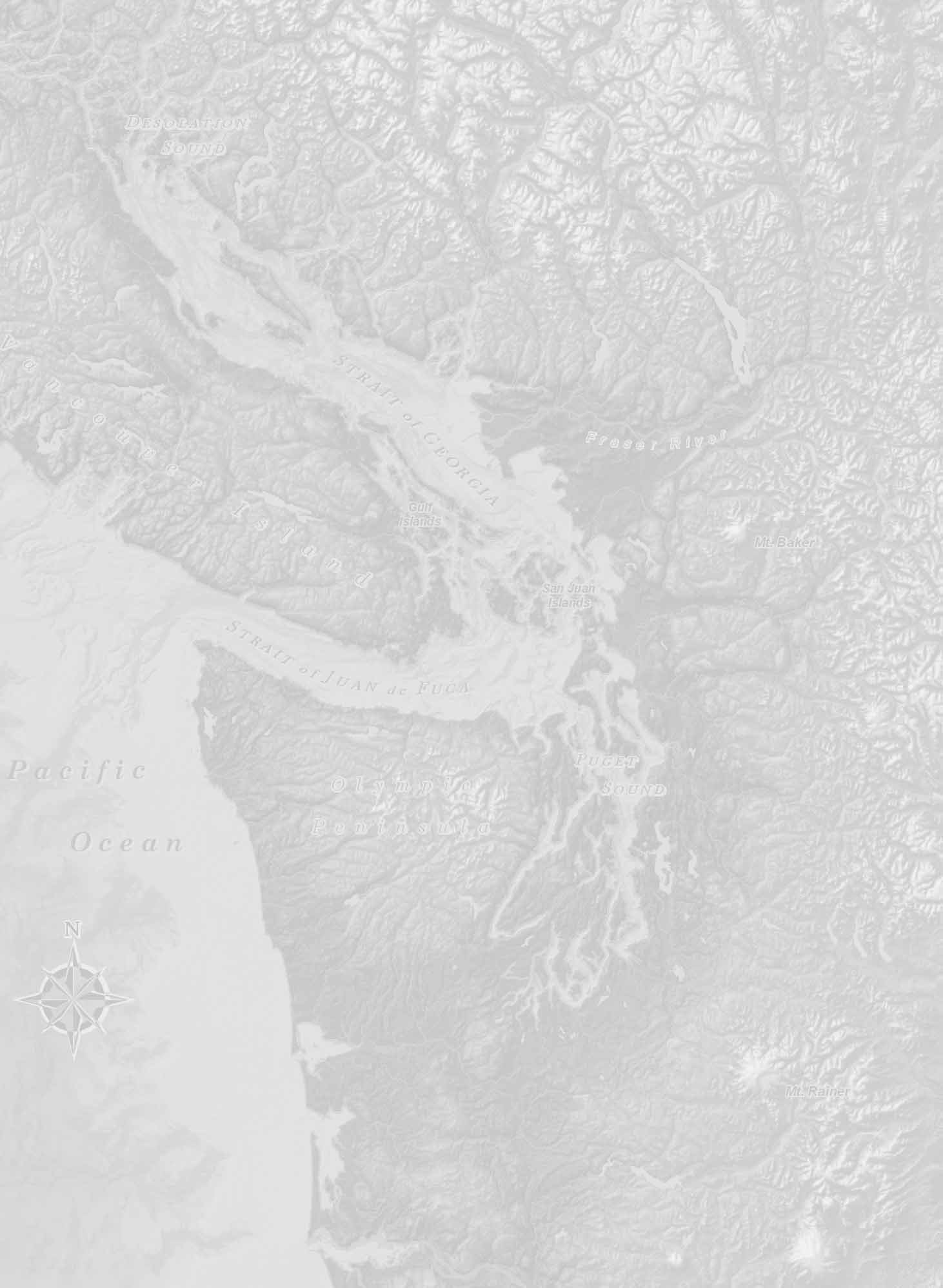
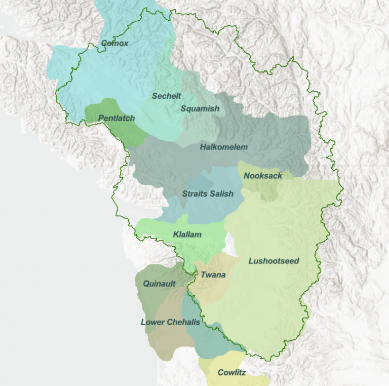
In the meantime, here are some examples of maps I think are relevant to the topic. While these are not maps of the Salish Sea, per se, they cover the same area.
Coast Salish Territories: Late 18th to Mid-19th Century, Hillary Rudd, 2004
Coast Salish Languages in the Early 19th Century, Hillary Rudd, 2004 (see Coast Salish Languages)
Coast Salish Language Territories, Deborah Reade, 2017 (see also Burke Museum Coast Salish Languages)
Web Maps
Coast Salish Languages, Salish Sea Atlas web map, Aquila Flower, et al, 2023

Native Land web map, with Territories as Languages, 2023